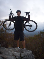
 Essentially you start with a killer climb where you gain about 1600' of elevation over 3 miles. It's a steady climb on a fireroad that doesn't give you many breaks. The picture to the left is just about at the top of the climb. From there you'll hit some tight, rolling singletrack right on a hillside. The penalty for failure is pretty high on most of this. After a couple of miles this starts to descend and you get your first extended downhill on the ride.
You'll then hit the 2nd of the two big climbs. This one is about 800' of climbing over about 2 miles. The grade is extremely steep the first 0.3 miles or so, but it then flattens out to an easy to moderate climb the rest of the way. At the top of this climb you'll come to an intersection. You'll also be at the high point of the ride. You'll want to go straight for the ride and start heading down. There's a trail to the right that goes up about a mile and will take you to Strawberry Peak.

I hiked up about 1/8 mile towards Strawberry Peak. In this picture you can see the start of the downhill. If you look closely you can also see our bikes leaning up against a mileage sign.
(click on the picture to enlarge it)
From this point it's essentially all downhill back to the car. For the first 3 miles you get great views on fun singletrack. You'll then need to cross the highway and pick up the trail again at Redbox (just on the other side of the road). From this point you have about 4 miles left but most of this singletrack is in the trees. It's also a lot more technical with a lot of rocks in spots. It's a very different type of terrain than all the previous ride.
For a more detailed description with Nav Points and Pictures check here.
http://www.geoladders.com/show_route.php?route=74


