Saturday, February 9, 2008

Box Springs Park

Box Springs Park sits right between Moreno Valley, Grand Terrace, and Riverside. It's one of those mountains you see off the freeway with all the Radio Towers at the top. I haven't ridden all the trails in the area, mainly because every time I go I feel like I have to do the M trail. I finally realized last weekend why it's called the M trail (it's because it's near the spot on the mountain where they have the great big M for Moreno Valley). The M trail is a very technical 2 mile singletrack that starts at about the highest point of the mountain and ends at what I believe is the main park area in Moreno Valley. The end point is not far from Canyon Springs HS.

I used to think it was called Box Springs Park because people would dump there box springs in this area. When I use to go there up Peacock road I'd see mattresses and other junk that had been dumped. Thanks to this article I now know the origin of the name - http://www.pe.com/sports/outdoors/stories/PE_Sports_Local_D_out_feat_25.33f6281.html

It's a brutal place to ride in the summertime. As you can see, no trees, plus 100° weather. It's great out there at this time of year though.


Saturday, January 12, 2008

Has this ever happened before?

Have the hills at Hulda Crooks ever been this green before? Actually, I'm sure they have, but I really don't remember it happening last year. With all the rain we've had the last few weeks everything has turned green out here and the trails are in great shape.

The Jedi is the best it's been in a long time.


Tuesday, December 4, 2007

St. George, Utah

It's been almost a year since we took this trip. The first day in St. George we drove up to Gooseberry Mesa. That was one unique ride. Just watching these videos reminded me of how beautiful that place is. The second day in St. George we did a short ride at Bearclaw Poppy.

Gooseberry Mesa
I don't think I have the words to really describe this place. Basically, most of the ride is on a sandstone similar to Slickrock. The major difference in this ride is it's relatively flat without any big climbs or descents. It's more of a very gradual climb out and then gradual downhill coming back. There are a few different options of loops you can do. I think we ended up going around 18 miles. The scenery here is just unbelievable though. You have to see the videos and pictures just to get an idea of what it's like.

Bearclaw Poppy
This ride is sort of like a cross between a mt bike trail and a bmx course. There's all kinds of fun stuff out there. It's an up and back that's maybe 4-5 miles each way. The whole way up you're just looking around and salivating at how much fun you're going to have coming back down. Most of the video we have from this ride is at the top, aka - the Three Fingers of Death.

The Videos
Mike and I decided we'd both make a video of this trip, using the same footage, and have a friendly contest on who could make a better video of the trip. It took him a good 3 months to finish his and I just finished mine this week, so neither of us were really on top of things. In what was unplanned, Brian made a video the week we got back using just a couple of short video clips I had emailed him. His is a lot shorter and still encompasses the overall feel of the trip so he gets the top billing here.


Brian's Video


Mike's Video


My Videos

Gooseberry Mesa


Bearclaw Poppy


Sunday, November 25, 2007

Cannell Plunge

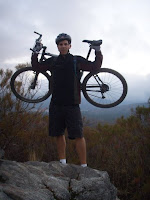
I finally did it. The Plunge! One of the biggest and best rides in Southern California. After doing the SART earlier this month (from Southfork to Morton Peak and then into Mentone - 35 miles total), this was my 2nd big shuttle in 2 weeks. And just like the first one there was plenty of climbing involved. But also like the first one, there was a whole lot of downhill fun.

- The Facts -
Beginning Elevation - 9200'
Ending Elevation - 2700'
2500' of climbing
A total of 9000' of downhill!!!
All this in 24 miles (although because of a wrong turn I made at the end Geno and I did closer to 28 miles)

- The Ride -
This ride has just about everything.
Fast smooth singletrack
Windy singletrack
Rocky technical singletrack
Narrow cliffside singletrack
Singletrack through meadows
Switchbacks
Steep technical singletrack climbs
Gradual fireroad climbs
A fun rock to play on
Even a stretch that could pass for a trials course
Oh yeah, also a spring about halfway down with fresh cold water

- The Unexpected -
I'd say the only thing I really wasn't ready for were the frozen creek crossing. It's a different feeling to go through a creek, and then realize you're not going through it, but instead you're skimming across the top of it on the ice. Very cool.

This is a great area to ride. Thanks to Geno for setting everything up. I'll be back as soon as I can, which I'm guessing won't be for another 6 months or so due to snow.


Tuesday, November 20, 2007

The Kona


It's been about a year since I got my Kona. Here's a video of my first ride on it.

Sunday, November 4, 2007

Freeride

I'd say I ride my xc hardtail 90% of the time, but I do like to get out and test my amateur freeride skills. Brian and I went out on Saturday and had a little fun.


Thursday, October 25, 2007

Palm Springs - The Goat Trails

Previously I thought this was part of the Art Smith trail, but apparently it's not. I've generally followed the geoladders route when I've been, but there are many variations you can make.

With school canceled for the rest of the week and the bad air quality from the fires, it was a perfect time to go down and ride the Art Smith Trail in Palm Springs again. I took the Kona this time. I figured it'd be more fun on the technical section in the last half mile. I can't say it was really worth it on the Kona though. It was over 90 degrees and those steep fireroad climbs got to me pretty quick today. The climbs are tough enough on my hardtail. Don't get me wrong, it was a blast coming down, but for the complete ride experience I think I'll stick to the hardtail for this ride from now on.

Regardless, it was still worth the drive down. If nothing else, I was able to breath clean air and get some exercise at the same time. I also brought the camera so I could get a few pics of the trail this time. Most of these are from the last 1/2 mile section of the ride.


Click on a picture to enlarge it.


Probably the most technical ............................ Nice little drop here. ..........................The last fun section of the ride.......
section of the trail.


This is up a little higher on the ride....................Lots of Rocks!..........................
Notice the steepness of the fireroad to
the left. Also notice the lack of shade.