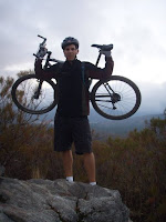
I did the Crafton Hills Time Trial today - (trail description) - and went 18:52.
It seemed pretty routine. I worked getting up, but I didn't kill myself. I think if I really pushed it I could get under 18:00 again. This is a great time of year to ride. I went around 6:00pm and it was probably about 70 degrees out.
Tuesday, September 25, 2007

Sunday, September 23, 2007
South Fork - SART
Brian and I rode a section of the SART today. We went from Glass Road, up to South Fork, and then back to Glass Road on the SART - a total of about 12 miles. It was a beautiful afternoon. It was mostly sunny with just a few clouds and probably in the low to mid 50s for most of the ride. Also, as I predicted, we didn't see another rider on the trail.
Obviously this was 9/23/07 (not 08)
For a complete description of rides on the SART check my previous entry -
Santa Ana River Trail
Obviously this was 9/23/07 (not 08)
For a complete description of rides on the SART check my previous entry -
Santa Ana River Trail
Sunday, September 16, 2007
We Have it Good!!!!!

I searched around the internet and found this picture of a race that Mike did in Wisconsin last weekend.
Notice there isn't even an actual trail, the grass is just cut real short where you're supposed to ride.
This is mountain biking?
Let's all take a moment and appreciate the riding we have here in Southern California.
Monday, September 10, 2007
Crafton Hills
The Crafton Hills fireroad starts by the tennis courts at Crafton Hills College. It goes up a few miles and you get some options of some nice singletrack trails which end up either in or near Yucaipa Regional Park. There are many options you have as far as loops go. I'll post more about those some other time.
Today I did the time trial Mike and I would do sometimes. He's since moved to Wisconsin (hope he's at least enjoying his road bike) so I'm on my own with this time trial for now. My fastest times have always come with him starting a couple minutes behind me and trying to catch me.
The ride starts where the gate is, right where the dirt road starts, just past the golf course. It ends about 2.4 miles up the fireroad right where it flattens out for a short stretch.
I went 19:41 today. I don't feel too bad anytime I can get under 21 minutes so today went pretty well. My best time is 17:41. Mike's best is 16:25, which he did trying to chase me down when I rode my 17:41. 16:25 is awfully good when I think about how hard I had to work just to get under 18 minutes.
A Map of the Crafton Trails
Updates
PR = 14:08
7/3/07 - 19:52
7/10/07 - 17:41
9/10/07 - 19:41
9/25/07 - 18:52
11/8/07 - 21:30
1/20/08 - 19:58
6/29/08 - 23:55
7/21/08 - 23:51
8/5/08 - 18:50
9/20/08 - 16:57 (SS) <----First ride on the SingleSpeed
10/4/08 - 18:04 (SS)
10/29/08 - 17:55 (SJ)
12/28/08 - 19:55 (SJ)
2/16/09 - 18:25 (in the rain)
3/16/09 - 14:53 (SJ) <---Destroyed my old record GPS on Motionbased
5/5/09 - 14:08 (SJ)
7/2/09 - 17:41 <----- On the Tandem
7/15/09 - 14:32 (Sp)
12/29/09 - 15:05 (Sp)
1/26/10 - 18:33 (Sp)
5/30/10 - 17:58 (Sp)
7/6/10 - 17:59 (Sp)
9/1/10 - 16:02 (SS)
12/11/10 - 15:44 (CX)
Key
SJ = Stumpjumper
SS = Singlespeed (KHS)
nothing = Fisher Big Sur hardtail
Sp = Intense Spider
Sunday, September 2, 2007
Whiting Ranch
I don't get down to Orange County to ride all that often. There is good riding there, but the truth is the crowds really bug me. I did go down this weekend and rode at Whiting Ranch. Whiting is the only spot in OC that I've been to more than just a couple times (probably 10-15 times). There are certainly better spots, but Whiting seems to be the most convenient (just off the 241) and you do get a little of everything in the main loop. At least it wasn't crowded on this day...probably because of the 100 degree weather.
The ride starts right off the Ralph's parking lot. You'll start with a very easy climb of about 1.5 miles. I believe this is the only section of the ride that is one-way. You'll also see quite a few hikers on this part. Most of this is under tree cover and is very pleasant scenery. It's easy to forgot you're not more than just a couple of minutes from a grocery store parking lot.
This trail takes you to Mustard Road where you'll make a right. You can make a left instead for a very short and fun little loop (about 1/3 mile in total length). Mustard Road is the one big climb on this ride. It's really not that big, but it'll make you work. It's maybe 1.5 miles and it gradually gets steeper as you get closer to the top. Once at the top you'll be at the highest point of the ride. As a reference point, you'll be just below the top of the Dreaded Hillclimb (http://www.geoladders.com/show_route.php?route=550).
There are lots of routes you can take down (or up..to the top of Dreaded). You could also continue on, get on the highway for a short stretch, and then get on the Santiago Truck Trail. The most popular way down (also, the most fun) is down Cactus. This is a tight, swerving, mildly technical singletrack with, you guessed it, cactus along the side. The first half of the video below shows this section. You then have a short, but steep climb and you get another downhill. This one a little steeper and more technical. The second half of the video shows this.
You'll then finish on some downhill trails through the trees. These aren't very technical but can be pretty fun. This comes out at the road. Make a right if you need to get back to the Ralph's parking lot.
This video is not from this weekend. It was actually one of the first times I used my helmet cam, so the footage is not great. Unfortunately the quality is not very good either.
Check geoladders for a more detailed description.
http://www.geoladders.com/show_route.php?route=1438
The ride starts right off the Ralph's parking lot. You'll start with a very easy climb of about 1.5 miles. I believe this is the only section of the ride that is one-way. You'll also see quite a few hikers on this part. Most of this is under tree cover and is very pleasant scenery. It's easy to forgot you're not more than just a couple of minutes from a grocery store parking lot.
This trail takes you to Mustard Road where you'll make a right. You can make a left instead for a very short and fun little loop (about 1/3 mile in total length). Mustard Road is the one big climb on this ride. It's really not that big, but it'll make you work. It's maybe 1.5 miles and it gradually gets steeper as you get closer to the top. Once at the top you'll be at the highest point of the ride. As a reference point, you'll be just below the top of the Dreaded Hillclimb (http://www.geoladders.com/show_route.php?route=550).
There are lots of routes you can take down (or up..to the top of Dreaded). You could also continue on, get on the highway for a short stretch, and then get on the Santiago Truck Trail. The most popular way down (also, the most fun) is down Cactus. This is a tight, swerving, mildly technical singletrack with, you guessed it, cactus along the side. The first half of the video below shows this section. You then have a short, but steep climb and you get another downhill. This one a little steeper and more technical. The second half of the video shows this.
You'll then finish on some downhill trails through the trees. These aren't very technical but can be pretty fun. This comes out at the road. Make a right if you need to get back to the Ralph's parking lot.
This video is not from this weekend. It was actually one of the first times I used my helmet cam, so the footage is not great. Unfortunately the quality is not very good either.
Check geoladders for a more detailed description.
http://www.geoladders.com/show_route.php?route=1438
Sunday, August 26, 2007
Strawberry Peak
We went and rode the Strawberry Peak loop yesterday. It was just my second time there, and I have to say it may be my favorite ride in Southern California. The SART has it on length and Noble Canyon has it on technical challenge, but for a good challenging ride I think the 16 mile loop at Strawberry Peak has it all.
 Essentially you start with a killer climb where you gain about 1600' of elevation over 3 miles. It's a steady climb on a fireroad that doesn't give you many breaks. The picture to the left is just about at the top of the climb. From there you'll hit some tight, rolling singletrack right on a hillside. The penalty for failure is pretty high on most of this. After a couple of miles this starts to descend and you get your first extended downhill on the ride.

You'll then hit the 2nd of the two big climbs. This one is about 800' of climbing over about 2 miles. The grade is extremely steep the first 0.3 miles or so, but it then flattens out to an easy to moderate climb the rest of the way. At the top of this climb you'll come to an intersection. You'll also be at the high point of the ride. You'll want to go straight for the ride and start heading down. There's a trail to the right that goes up about a mile and will take you to Strawberry Peak.

I hiked up about 1/8 mile towards Strawberry Peak. In this picture you can see the start of the downhill. If you look closely you can also see our bikes leaning up against a mileage sign.
(click on the picture to enlarge it)
From this point it's essentially all downhill back to the car. For the first 3 miles you get great views on fun singletrack. You'll then need to cross the highway and pick up the trail again at Redbox (just on the other side of the road). From this point you have about 4 miles left but most of this singletrack is in the trees. It's also a lot more technical with a lot of rocks in spots. It's a very different type of terrain than all the previous ride.
For a more detailed description with Nav Points and Pictures check here.
http://www.geoladders.com/show_route.php?route=74
 Essentially you start with a killer climb where you gain about 1600' of elevation over 3 miles. It's a steady climb on a fireroad that doesn't give you many breaks. The picture to the left is just about at the top of the climb. From there you'll hit some tight, rolling singletrack right on a hillside. The penalty for failure is pretty high on most of this. After a couple of miles this starts to descend and you get your first extended downhill on the ride.
You'll then hit the 2nd of the two big climbs. This one is about 800' of climbing over about 2 miles. The grade is extremely steep the first 0.3 miles or so, but it then flattens out to an easy to moderate climb the rest of the way. At the top of this climb you'll come to an intersection. You'll also be at the high point of the ride. You'll want to go straight for the ride and start heading down. There's a trail to the right that goes up about a mile and will take you to Strawberry Peak.

I hiked up about 1/8 mile towards Strawberry Peak. In this picture you can see the start of the downhill. If you look closely you can also see our bikes leaning up against a mileage sign.
(click on the picture to enlarge it)
From this point it's essentially all downhill back to the car. For the first 3 miles you get great views on fun singletrack. You'll then need to cross the highway and pick up the trail again at Redbox (just on the other side of the road). From this point you have about 4 miles left but most of this singletrack is in the trees. It's also a lot more technical with a lot of rocks in spots. It's a very different type of terrain than all the previous ride.
For a more detailed description with Nav Points and Pictures check here.
http://www.geoladders.com/show_route.php?route=74
Saturday, August 4, 2007
Bridge Drop


I got the first bridge dropoff I made all setup and in place. It's a 2 foot drop. With the slope of the hill it ends up being 3 - 4 feet.
I have plans to put a few other structures along the ridge. Recently I put a 1 foot drop about halfway down on the right. The bottom of the ridge drops you into a nice little curvy canyon trail that goes back to the parking lot.
This picture shows the singletrack I dug out to get to the ridge with the bridge dropoff.
Subscribe to:
Posts (Atom)